We use our own and third-party cookies for analytical and technical purposes, processing data necessary to create profiles based on your browsing habits. You can find more information and configure your preferences in 'Cookie Settings'.
 Back
Back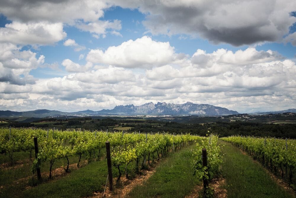
Located in the heart of the Catalan Prelitoral depression, Sant Sadurní d'Anoia belongs to the Alt Penedès region and the Penedès vegueria. The term, of 18.96 km², is located 162 m above sea level and is divided by two small valleys: to the north, that of the Anoia River, and to the south, that of the Lavernon stream, both tributaries of the Llobregat. Vineyards occupy most of the landscape — 872 ha of agricultural area used (2020) — and draw a green and ochre tapestry that changes with the seasons.
The municipality is bordered by Subirats and Gelida to the east, Sant Llorenç d'Hortons and Piera to the north, Terrassola and Lavit to the west and, again, Subirats to the south. Barcelona is 45 km away and Vilafranca del Penedès, the regional capital, is just 10 km away. The protection of the Prelitoral mountain range and the proximity of the Mediterranean give the town a mild climate: mild winters (average 7-9 °C) and warm summers (25-30 °C), with rainfall around 550-600 mm per year, usually concentrated in spring and autumn.
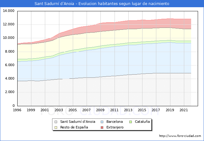
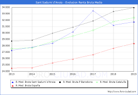
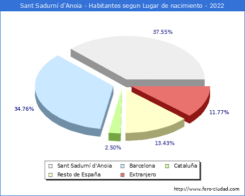
Demographically, the town has 12,930 inhabitants (2025), of which 6,350 are men and 6,580 women. The density is about 682 h/km². 74% of the population was born in Catalonia, 12% in the rest of Spain and about 13% are of foreign origin. The majority of residents (67%) are between 15 and 64 years old, while the children (0-14) group represents 14% and those over 65 years old, 19%. The territorial socioeconomic index places Sant Sadurní above the Catalan average (IST 107.2) and the GDP per inhabitant slightly exceeds the national average (38,830 €/inhabitant).
Economic activity continues to be linked to vineyards and cava, but diversification is evident in the services sector (2,780 affiliations to the general scheme) and in an auxiliary industry specialising in packaging, oenological machinery and food. Excellent communications — AP-7 and C-15, the R4 Rodalies line and local roads to Martorell or Vilafranca — reinforce its role as a regional market hub.
Environmental management is also remarkable: the town generates 1.16 kg of municipal waste per inhabitant per day, of which 82% is collected selectively (as of 2024), one of the highest figures in the country. The commitment to sustainable mobility is embodied in pedalable paths between vineyards, hiking routes signed as “Camins por la Capital del Cava” and a network of bicycle parking.


 CAT
CAT ESP
ESP FRA
FRA POR
POR ITA
ITA ALE
ALE NLD
NLD ZH
ZH JA
JA